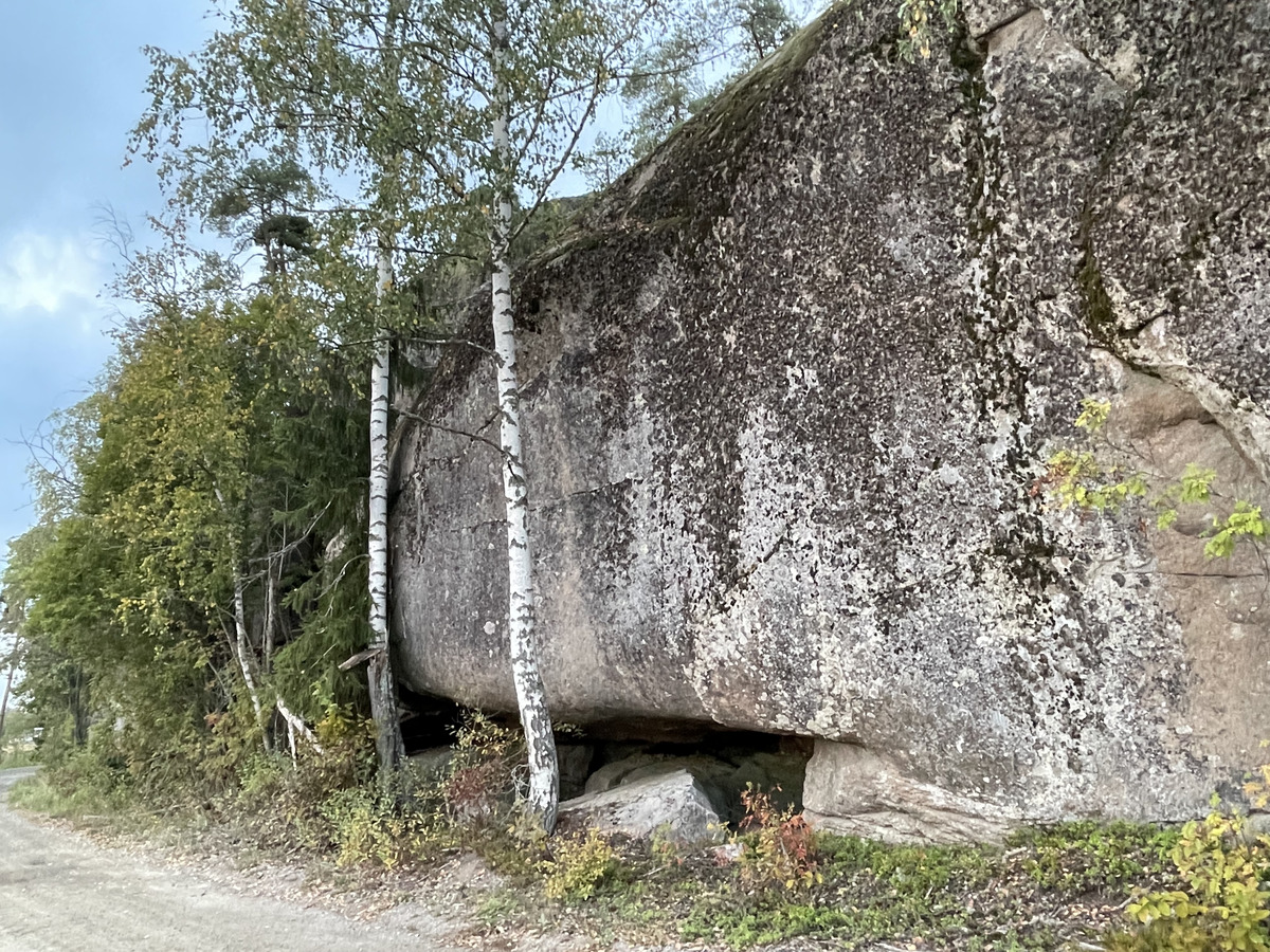
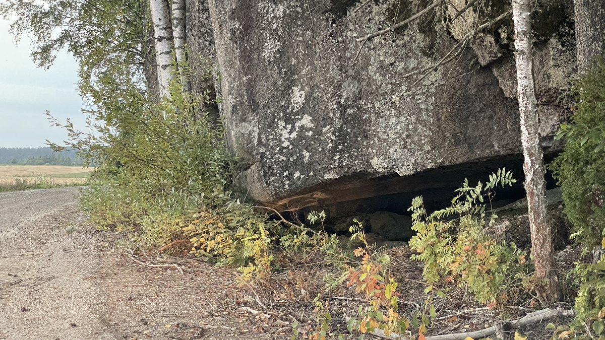
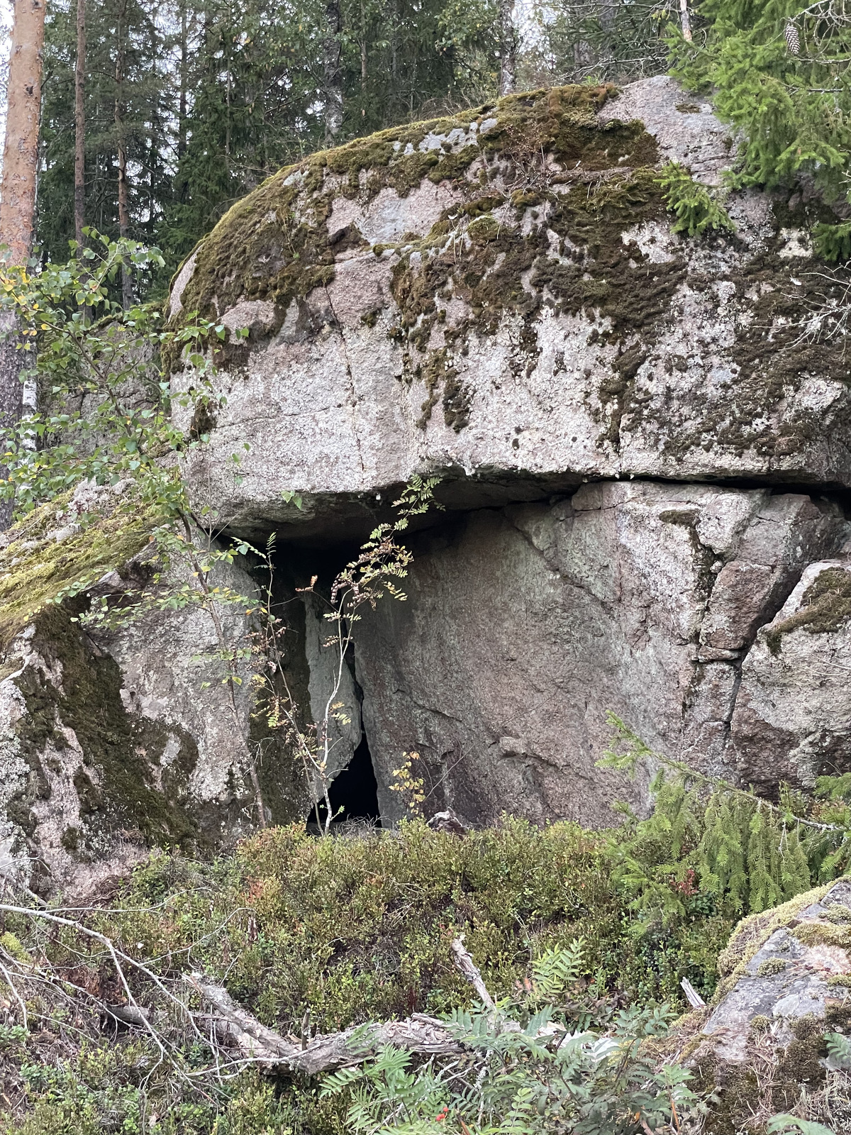
On the way back from the Lahti swimming pool visit, I stopped in Lapinjärvi to look at a cave that I had not previously been to, the Soidenkallion onkalot (or "swamp cliff holes" in rough English translation). This is a shelter cave formed through a horizontal crack and erosion at the bottom of a cliff.
It wasn't particularly deep or super easy to crawl through given its low roof, but it was a cave alright. Nice quiet area to visit, too, and easy parking.
Glad I went!
I knew about the cave through the Finnish Caving Association's map (accessible here).
Of course, the map doesn't magically have the information about caves, it comes from somewhere. Among other sources, the map incorporates caves listed in the book Suomen luolat ("Finnish Caves") by Kesäläinen, Kejonen, Kielosto, Salonen, and Lahti. They've spent decades collecting local knowledge about possible caves and went and checked most of them. Impressive!
But back to Lapinjärvi. There's actually three separate caves, the main cave and two small side caves.
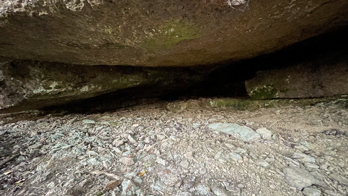
The main cave is at the coordinates N 60.657354 E 26.023939.
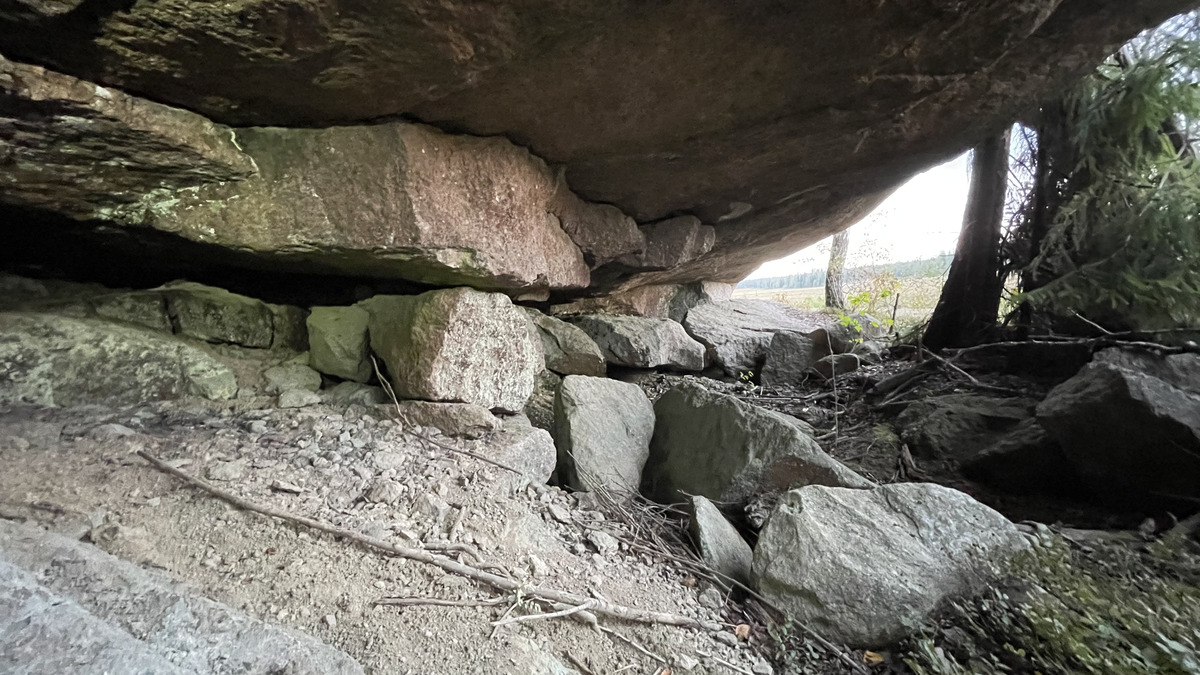
Inside it looks like this:
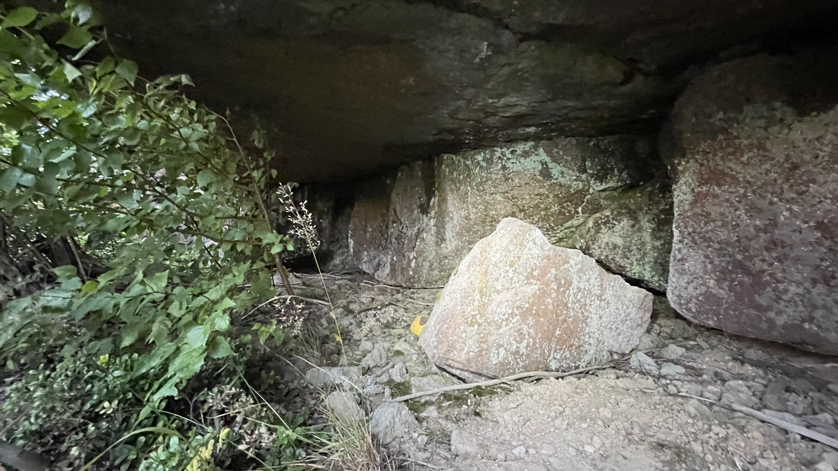
There are two small side caves, the bigger one of these is at the coordinates N 60.657490 E 26.023870. This cave is basically an unconnected continuation of the main cave, a few meters (maybe 5) of the crack under the cliff, going in a few meters inside.
The smaller one of the side caves is just couple of meters (maybe 3), a tiny roof shelter and then a continuation under some boulders. This cave is at the coordinates N 60.657892 E 26.023652. Photo:
I 3D scanned the main cave. The Suomen Luolat book indicates the size of the cave being 1-5m x 25m. I measured it as 29m wide and up to 5.2m deep.
The 3D model can be downloaded here, or rotated on screen here. A screenshot of the model is below:
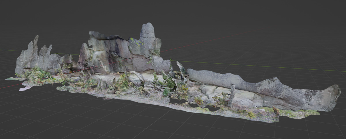
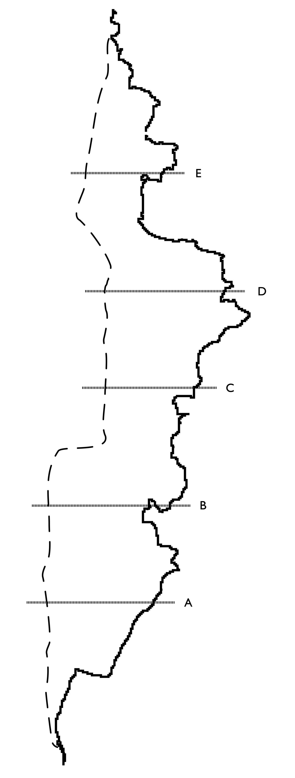
I also used the 3D model to automatically (mostly) generate a cave map. The high resolution version of the map can be downloaded here, but the below image shows the main plan view part:
In the main cave there was an object that I didn't know what it was but ... I really didn't want to touch it. Please don't visit this cave or if you do, be very careful:

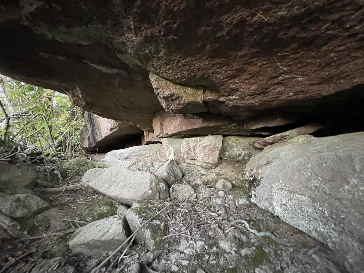
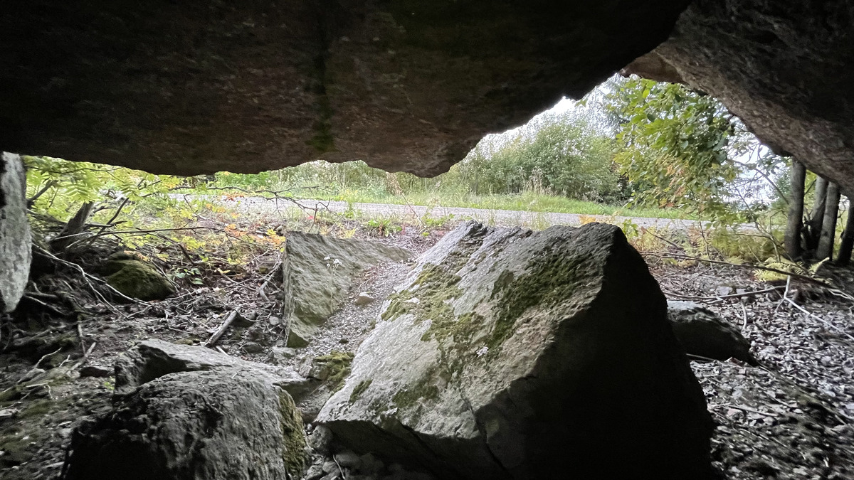
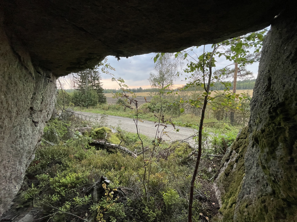
More photos of the main cave:
More photos of the first side cave:
More photos of the second side cave:
Read the full Planetskier series at planetskier.net, urban exploration stories from theurbanexplorer.net, and other underground stories from planetcaver.net, or all blog articles from Blogspot, TGR. Photos and text (c) 2025 by Jari Arkko. All rights reserved.
This article was originally published in the Planetskier Blogspot article series.
"Mongolia is kind of close, right? Story about an attempt to ski everywhere in the world where there's snow. And in some places where there isn't. On and off-piste skiing on all continents, skiing into craters of live volcanoes, climbing, photography, and travel." The Planetskier blog focuses on skiing, caving, climbing, biking, flying, sauna, and swimming adventures around the world. See the other Planetskier blog articles about skiing, caving, urban exploration, climbing, cycling, flying, swimming, and saunas.